view from Bubb's Creek trail
I don't know who is going to read this whole thing but I wrote it anyway. Melissa and I have been going to Kings Canyon off and on since 2002. I know that I will continue to do so for the rest of my life. We both really love the place. It sits at the end of a dead-end road which I think is part of it's allure. Once here I don't have the usually 'road fever" I get on vacations. "what's around the next bend?". Well, there is none. You are here and this is it. And it is amazing. Reading forward you'll find a broad decription of what you'll find in the canyon followed by a short description of what we actually did.

cold beer after a hike
Kings Canyon National Park is one of California's best parks in my estimation for a variety of reasons. The park sits on the western slope of the Sierra Nevada mountains just north of Sequoia National Park and to the south of Yosemite. It's location at the end of a dead-end road makes it the least visited of the three parks. People don't just pass through and stop. You have to take a rather narrow and windy road to get down to it's head quarters at Cedar Grove. It is a spectacular drive but the 36 miles can take you much longer than you think since you'll be going 15 miles per hour at times and dropping up and down several thousand feet.

hard to see in the picture above but there is a car in the lower center for scale

the road
But let me back up a tiny bit first.

Sequoia and Kings Canyon - two parks in one.
When you first enter Kings Canyon National Park you'll most likely enter through Grant's Grove. While this is actually part of Kings Canyon NP it really could be part of Sequoia NP. There is a bit of overlap here between the two parks. Grant's Grove is located at 6500 feet and the main attraction here is the giant Sequoia trees located at Grant's Grove. So if you are heading for KCNP you get a two for one since it's only a 5 minute detour to visit the massive trees. Located here too is the visitor center, market and restaurant. I'd suggest getting any last minute essentials you might need at the market since they may be out down in the canyon. You should have already bought most of what you need back in Visalia or else where since these markets carry only basics. This year I bought a can of propane. Which was smart since they were out at Cedar Grove. They do have a coffee bar. And the visitors center is worth a visit.
Usually we drive up to Grant's Grove on day one of our trip and camp at the Azalia camp ground. There are several other camp grounds there but this is the one we like the best. Day one gives us an easy drive and a quick way to get into camping mode. It is at 6500 feet so it can be cool at night. If the weather is warm it's worth staying up at GG for and extra day. There are some nice hikes in the area. One in particular is the Boole Tree Loop. Here you can get up close to the Sequoias. But you have to hike a bit to do so. You can also visit Stump Meadow. I'll leave you to guess what you'll see there.

The Lincoln Tree
Once we leave Grant's Grove we are now headed into Kings Canyon on HWY180. This year we were stopped for a little road work which is common in the mountains. The signal man can over to tell us to wait and we engaged in a little small talk. " you going camping?" I'm guessing all the camping gear in the back of my truck clued him in. I felt like saying " wow, you must be psychic!" But that's city rude. I just said "yes, can't wait". He then told us it was going to be smokey since there was a fire burning down in the canyon. WTF? This fire has be burring since July. A controlled burn. I never saw it mentioned on the NPS website. ( I did find the notice when I got back home but it seemed like a footnote.)
Once we got the "all-clear" we continued on 180. This road was built in the 1930's and opened in 1940 . You'll be amazed when you drive on it thinking about how they did it. There is an area called Convict Flat which might give you a clue. But before you really head down you might need to take one last detour to Lake Hume. It is the last place to get gas. I always fill up there. ( there is no gas at GG or in KC ) The road to Lake Hume gets really narrow and needs some pot holes to be filled. The lake is very scenic. Here you'll find a summer camp and a gas station. There is a National Forest campground on the lake but all the good sites are by reservation and always taken months in advance.

Lake Hume
Once you fill up with gas you get back on 180 and really head into the canyon. The road is basically taking you east and down. You will normally be greeted with amazing views of the high Sierras and two canyons heading back into them. These are formed by two forks of the Kings River. This year it was very hazy due to the smoke. As you drive you head out of the pine forest and into typical California chaparral country. All the while the road will become increasingly narrow and windy. You will pass Kings Canyon Lodge. ( This technically is the last gas station but they only sell you 5 gallons for emergency use.) Past this point the outer canyon really starts. Here you'll begin to have steep drop off's on one side of the road. This outer canyon is completely different than Kings Canyon. This is a river cut canyon. A gorge really. Very narrow with nearly vertical walls. The rock wall here is red stained. Pull over at a few of the vista points. The views are amazing. You'll be able to hear and maybe see the river hundreds of feet below.

HWY 180
Eventually you will work your way down to the river near Boyden's Cavern. (more on that later) The road crosses the river and heads into the park with the river roaring on your right hand side. You'll see people fishing mostly. This year we got to see smoke and fire. There were some fire crews milling around and flames and lots of smoke. But soon enough we past all that and crossed the river again. Hear the canyon starts to widen out a bit and we come to our first campground, Sheep Creek. Next is Cedar Grove where you'l find the ranger station, visitor center, Sentinel campground, KC lodge and the market. We always check Sentinel first for a good campsite. If you can't find one here go back to Sheep Creek and pick through what is available.

View from our campsite
Sentinel campground is like most campgrounds. Out of 89 campsites there are about 12 really good ones, 12 really crappy ones and a everything else. Sentinel has a a few campsites right on the river but is also has a meadow with campsites around that too. There is one site in particular we like and this year it was open. It sits on a corner of the meadow with the river just across the road. There are no campsites next to it but there is one sort of behind it. But it's mostly on it's own and unlike the other meadow sites it has open access to the meadow. So you can pitch your tent right on the edge of the grass. Which is great since most car-campsites are very dusty. The river is close enough too to walk right over to and drink a beer. Each campsite has a fire ring and a bear box. Did not see any bears this year unlike 3 years ago when we saw bears every day. We are thinking the proximity of the fire may have sent them to different section of the park.

late afternoon at our campsite
The other facilities here include the visitor center where you can get trail info, weather forecast, etc. And across another bridge is the lodge and market. The "lodge" should really be called the motel. Since it has none of the things you think of a lodge having. There is no massive fireplace and lobby. They have a cafe and basic rooms. We have eaten at the cafe once. Breakfast I think. Basic and what you'd expect. They do have hot showers there for 4 bucks. The market has basics: Beer, soda, ice, canned goods, ice cream and basic camping gear. They even sell a small assortment of hard liquor. You can buy fire wood here too. But you are allowed to pick up any fallen wood you find so we usually go out and collect a huge pile in no time.

a little farther to go
So now we are at Cedar Grove but the real canyon is just up the road. Don't get me wrong. At this end we have very high granite ridges and it's very nice but it gets better. It's about six miles from here to Road's End. It's great name, Road's End. Between here and there we have the inner canyon, Zumwalt Meadow, Roaring River Falls, Muir Rock and all the trail heads at Road's End.
The inner canyon widens out even more and it reveals the vertical granite walls and flat bottom that tell you this is a glacial valley. Just like Yosemite. In fact this is a smaller version of Yosemite. Of course it's not as big and fabulous as Yosemite but it's close and it has about 90% less visitors, which is why we come here. There are numerous water falls but like Yosemite the early summer is when they are at their height. Roaring River Falls seems to run all year though. It's just off the road and really amazing.

Zumwalt Meadow
Zumwalt Meadow is next. It's a beautiful meadow, duh, right? There is a 1.2 mile trail that takes you around it after you cross the river on one of the numerous foot bridges you'll find in the park. Right by the foot bridge is a nice sandy beach I always keep meaning to eat lunch at. And possibly, I mean maybe, jump in the river. The water is effing cold. But people do jump in. Just don't get swept away cause you won't last long.
Down to Road's End
Road's End is where you'll find Muir Rock and trail heads into the back country. Muir Rock is just south of the parking lot. Walk to river and there it is. John Muir used to give talks standing on the rock. In fact the park was originally going to be called Muir National Park. 3 years ago there where all these teenagers jumping off the rock into the frigid water. They were having a great time. I would have done it but I had just washed my hair the night before.

Muir Rock

Jump in
The trails that lead out from Road's End are Mist Falls, Bubb's Creek and Copper Creek. We have done all three and this year we did Bubb's and Copper. Copper we did for the first time this year.

Copper Creek trail head
Copper Creek Trail is one which I wouldn't really do again. I hate saying that since any hike up here is amazing but the amount of effort to reward ratio is out of balance when compared to the other hikes. Copper is all vertical gain and switch backs. We did about 4-5 miles up gaining about 3000 feet. The view was amazing. You can see into the Sierra backbone and the western divide. But like I said it's very taxing to get up there. So we did a 9-10 mile round trip. Hard to say how far we went since there are no markers on the trail. We did about 2 1/2 hours up and we both walk pretty fast. We can easily make 2 miles per hour even on a steep trail like this.

smokey view from Copper Creek trail
The other two hikes from Road's End are better I think. Both trails share the first 2 miles which is over even flat ground. This section always seems longer on the way back and on a hot day can be really hot and dry. This flat section takes you to a junction where you can either go across the really cool bailey bridge and take the Bubb's Creek trail or hang left and take the Mist Falls / Paradise Valley trail.

river bridge at the trail junction. 2 miles from Roads End
The Bubb's Creek trail takes over the bridge and through a thick pine forest and through what I can only describe as a delta. Bubb's Creek comes down through this area in several fingers and the trail takes you through this. You'll cross 4 more but smaller bridges as you walk up a slight grade. Here you'll see small water falls and wild flowers, ferns and up-rooted trees. Eventually you'll come up to the granite shoulder of a massive valley wall. Here the trail begins a series of switch-backs. This is the hardest section of the trail but it's not too hard. You do have to gain about 800 feet overall. The views become increasingly rewarding with some of the best panoramas of the entire canyon I think you'll find. You also get views of Paradise Valley. Once you beat the switch-backs the trail rounds the shoulder and takes you up to Sphinx Creek Junction where you'll find a bridge. To this point is 4.1 miles. We really like this trail and it seems like a good trail to do when we first get up to the park. The round trip is 8.2 miles with about 800 foot gain. In 2007 we came across 4 different bears up here. This year none. By the time we reached the bridge the wind had pushed the smoke back to the west so the views were unobscured.

crossing the bridge

Mel on one of the many foot bridges in the park

The Mist Falls trail really gives you a great variety of terrain. It is however the most travelled trail in the park I would guess. Mist Falls is the highest water fall in the park so everyone wants to take a look. Once you split at the bridge the trail takes you through a fern gullies and shaded forest. It can be a bit buggy at times but is really cool. The trail follows Wood's Creek and at times it is right there next to you. But eventually you'll hit an upgrade where you'll start gaining the 600 feet you need to get to the falls. You hit an exposed zone with excellent views both up and down the valley. There are sections where you can look down into a very deep gorge with the creek a couple hundred feet below. Eventually you'll come to Mist Falls. It is a very cool water fall. My only complaint is finding trash up there. I'd really like to catch someone leaving behind a one gallon plastic water jug or a beer can. Melissa and I went up above the falls for even better views of the valley and less people. Round trip on this trail is 9 + miles. We didn't do this trail this time. We wanted to finally check out Copper Creek. No question that I'd do Mist Falls over Copper any day of the week.
trail head
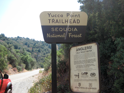
The other trail we did this time was Yucca Point trail. We decided that since it was so smokey in the valley that we'd try something back up the road. The trail head is very near the Kings Canyon Lodge. ( not the park lodge but the private one further back .) The trail takes you down through chaparral hill country down to where the middle and south forks of the Kings River meet. There are no milage markers but we guessed it would be about 1.5 - 2 miles one way. It's rather dusty and dry but you get some great views of the middle canyon. Before we made it all the way down the trail started to follow Ten Mile Creek. Here we could see a massive granite wall where the creek water falls down. There isn't a lot of water in September but you could tell that in early spring this would be crazy. Even in September you get some waterfall action. There is a spur that we took that takes you right down to Ten Mile Creek. Really amazing jumbles rocks and water falls. We ate lunch here and lazed around in the sun. It's a good place to wash your feet and look for fish, etc. Here we met a guy and a girl who where going canyonering . They were donning wet suits and helmets with the idea being to navigate down Ten Mile Creek and then take the trail back up. I think I'd actually like to do this. We basically did this when we are kids but with-out the gear. We didn't have a cool name for it either. We just called it being stupid. In a good way.
We did look for a trail at Convict Flat campground. On old couple told there was some kind of trail but it looked hard and dangerous and who knows where is goes? So we did the Yucca Point trail instead.

2010 was a bit smokey
2010 Trip
So, in 2010 we spent 5 days in the park. We had a lot of smoke from the fire but it made for some great light at times. The first day we got there the weather had been hot but a cold front blew in. So it was down into the 50's early in the evening and super smokey. And then it began to rain. Rain? In September? WTF? I was starting to think of plan B for the rest of our vacation time. But anywhere else in the mountains would be even colder. Maybe no smoke but colder. One of the nice things about KCNP is that the canyon is at 4000 feet. You still feel like you are up in the mountains but you get much warmer days and nights. Usually 10 degrees or so. But the next morning dawned bright and blue and no smoke. You could tell the day was going to be nice and warm. And the warming trend continued through the week. So it felt like full on summer still. The Aspen trees really didn't even have a hint of autumn on them yet. The smoke came and went. At times it was really noticeable but never severe. The Rangers said this was the best it had been in weeks. So while a nuisance it was never a real issue. Cough, cough.

the smoke did create a nice warm light every afternoon.

big head
For breakfast we had coffee and cereal. For lunch we'd make sandwiches to take hiking. Apples and trail mix too. For dinner we made things like quesadilla, grilled chicken, beans and vegetable tacos. The taco's were the best this year. We cubed a potato with some carrots and onions. Those were placed in a tin-foil tray with spice mix, oil and beer. That was cooked over the open fire. Then in another tin-foil tray we heated up corn torts with cheese. The stewed potatoes and carrots then went on the torts. Super good. Going to make that at home I think. We did a pasta dish one night that turned out blah. Mushrooms and white clam sauce. Conceptually it sounded great but it didn't work. We ate it anyway. And a good bar of chocolate always works for dessert.

afternoon book reading

Mel and a pinecone

table at night
campsite video
We didn't bring fishing poles. Maybe next time. You can't beat fresh trout. 2 trips back some fishing guys came over to our camp and asked if we'd want any fresh trout? They were over limit. We said no thanks, we don't know where that fish came from. The hell we did. The fish was even already cleaned! That was like gold dust as they say.
Each day after our hike we'd sit in the meadow and read a book or just relax and drink beer. That is about the best thing ever. At night we'd sit by the fire for a bit , drink some wine and then hit the hay. As you camp you hit the hay earlier and earlier and get up earlier. Our new tent is ok for a 100 buck tent. I would not trust it in a real reran storm but for this it's fine. We have a blow-up mattress and use flannel sheets and wool blankets rather than sleeping bags. It is so much better. Almost like your bed at home. Almost. I always put on clean socks and pajamas. Makes for a better nights sleep. We wash our feet and faces every day but other than that I don't mind being a bit dirty. At home I can't stand not to wash my hair everyday but when camping it doesn't bother me. I diid see this cool little camper. I have always wanted a tear drop camper but this seems like it might be a bit more practical. You can stand up inside.

maybe it's time to get off the ground?
Ok, so that was 2010. Not nearly long enough time up there but that's all our schedules would allow. I keep swearing that I'm going to get up there once or twice more each year. Next year I am going to be at Onion Valley for the meteorite shower in August. I promise. And then who knows maybe we'll be back in KCNP in September. Or maybe Hawaii. But in any case, we'll be back sooner or later. We have one last trail to conquer, the Don Cecil Trail.


buying some produce on the way home

HWY 178 closed due to fire
One last detour on the way home. A forest fire closed the highway along the Kern River. We were just 30 miles from Bakersfield but had to turn around and go through Mojave. I guess it added an hour to the drive home.
One last thing, usually when we get back into Los Angeles it looks really blah. Civilization, blah. But this time LA looked really cool and it was great to get back home.

just a few minutes from home
 Double Rainbow all the way. So bright so Vivid. Oh My God! There actually is a second one it there but it was real faint. This rainbow was so interesting a couple of news helicopters hovered over my house taking shots of it. lol.


